NISAR Mission: Monitoring Earth’s Surface with Unmatched Accuracy
Context
India has marked a major milestone in its space and climate science journey with the successful launch of the NISAR (NASA-ISRO Synthetic Aperture Radar) satellite from the Satish Dhawan Space Centre in Sriharikota. This mission is a significant example of international collaboration between India and the United States in space research, particularly in the field of Earth observation and climate monitoring.
Introduction
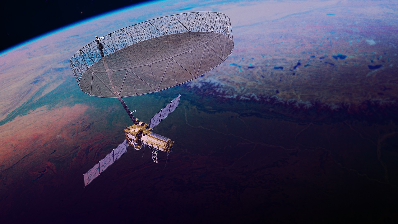
NISAR is a joint mission developed by the Indian Space Research Organisation (ISRO) and the National Aeronautics and Space Administration (NASA). It is the world’s first dual-frequency radar imaging satellite designed to observe and monitor dynamic changes on the Earth’s surface with high precision. The mission is expected to enhance understanding of natural disasters, climate change, agricultural patterns, and ecosystem transformations.
Key Features and Objectives of NISAR
-
Full form: NASA-ISRO Synthetic Aperture Radar
-
Launch Vehicle: GSLV Mk-II (LVM3)
-
Orbit: Sun-synchronous polar orbit at 747 km altitude with 98.4º inclination
-
Mission duration: 3 years, with a design life of at least 5 years
Major Objectives
-
Study changes in the Earth’s surface, including earthquakes, volcanoes, landslides, floods, and ice sheet dynamics
-
Monitor ecosystems, farmland productivity, and forest biomass
-
Capture high-resolution data with a spatial resolution of 3–10 metres and vertical mapping at centimetre scale
-
Provide repeated scans of each area every 12 days
Technical Highlights
-
Synthetic Aperture Radar (SAR) uses motion of radar antennas to produce fine-resolution images
-
L-band SAR (1.257 GHz) penetrates vegetation and soil to detect ground deformations
-
S-band SAR (3.2 GHz) captures surface-level features like crops and water
-
Operates in both horizontal and vertical polarisation, enabling material identification
-
Swath width of 240 km without sacrificing image clarity
-
Employs scan-on-receive technology for wide-area coverage
Contribution of India and the US
ISRO contributed:
-
I‑3K spacecraft bus, 4 kW solar power system, S-band radar electronics
-
Ka-band telecom subsystem, launch services, and high-gain antenna
-
Ground stations at Shadnagar and Antarctica
NASA contributed:
-
Complete L-band SAR system, 12-m antenna, 9-m carbon boom
-
GPS receiver, solid-state recorder, Ka-band communication system
-
Oversight of mission operations from Jet Propulsion Laboratory (JPL)
Mission Operations and Data Sharing
-
Flight operations managed by ISRO’s Bengaluru centre
-
Data transmitted via NASA’s Near-Earth Network in Alaska, Norway, and Chile
-
Capable of transmitting 3 TB of data per day
-
Processed and distributed in India by National Remote Sensing Centre (NRSC)
-
S-band radar focused on India-specific data for soil moisture and biomass mapping
-
Dual radar operations planned to minimise mode conflicts over Indian territory
Working Mechanism
-
Once in orbit, NISAR bounces radar pulses off the Earth’s surface
-
Measures time delay and phase shift of returning signals
-
Combines multiple echoes to generate high-quality, coherent images
-
Uses different polarisations to distinguish between soil, water, snow, vegetation, and infrastructure
-
Enables continuous monitoring, regardless of weather conditions or daylight
Significance of the NISAR Mission
-
First dual-frequency radar satellite for Earth observation
-
Operates day and night, through clouds, smoke, and dense forest cover
-
Delivers annual maps of aboveground biomass at 1 ha resolution
-
Produces quarterly cropland maps and flood mapping data
-
Provides damage proxy maps during disasters within five hours
-
Open-access data policy ensures benefits for researchers and governments worldwide
Conclusion
The launch of NISAR underscores India's growing expertise in advanced space technology and reinforces the strength of its international partnerships. By offering comprehensive, high-resolution data on Earth’s dynamic systems, the mission will serve as a vital tool for disaster response, climate adaptation, and sustainable development planning. NISAR is poised to transform the way Earth is monitored, making a profound contribution to both scientific research and policy-making in the years ahead.


Comments (0)